
Dearest everyone,
We hope you are well. Apologies for not being able to post sooner. A mix of poor WiFi and jam-packed hiking has meant writing up the days events hasn’t been as easy as we’d have hoped. We’re currently on day 90 can you believe (which shows just how out of date our blog has become) so we’ll try and get you all up to date while not missing any juicy bits. Since last we wrote we’ve been through the Shenandoah National Park, crossed 3 more state lines into Pennsylvania and set a new mileage record of 25.6 in one day. We are currently at mile 1143.1, over halfway!
However, to backtrack a little our tale continues at day 46 as we departed from Damascus. After a relaxful zero we headed back towards the trail, stopping off for ‘proper’ coffee at Mojoes Coffeehouse. It was, by far, the best coffee on the trail to date. The cawfee is by and large fairly poor, so this was a great treat, and coupled with an English muffin (a nice change from the American style biscuits/scones) and a homemade brownie it was fantastic fuel for the legs. But despite it, the first hill felt hard. The day off had made our legs a little sluggish and as we attempted the first 1,000 foot climb we took it a little slower than usual. The trail offered lots of interest as we crossed or followed the famed Creeper trail, which is a leisurely cycle route that most people get a ride up and cycle down.
We walked around 15 miles, taking us to mile 483.2, and stopped to camp at Lost Mountain shelter. It was bustling with hikers, as we have come to expect the first shelter out of town to be.
The next day turned out to be epic. We awoke with hopes of walking a record-breaking 23.2 mile day to Old Orchard shelter. Reports of poor weather in the area had abounded the night before, with rain expected between 7am and noon. Despite rising after 8am we were lucky in that the rain had barely materialised and the tent could be packed away easily. We snacked on granola bars, said goodbye to those left in the shelter and started on the 1830ft climb of White Top mountain. Trademark, a fellow thru-hiker we had met at the shelter the night before, left just after us and soon caught us up. A wise-cracking New Jersey boy, who proudly informed us that he can cycle into Manhattan in just 32 minutes and takes daily selfies of his beard.
The climb was long and not overly steep, but early in the morning it was hard to hit our 2mph par speed and already our 23.2 mile goal was looking a little suspect, but thankfully no more rain. Well, not until we had reached the most exposed part of the trail for that day, at Beach Mountain road, where we enjoyed a liberal spraying from above. A quick pause among the spruce saw pack covers and jackets adorned and the climb continued.
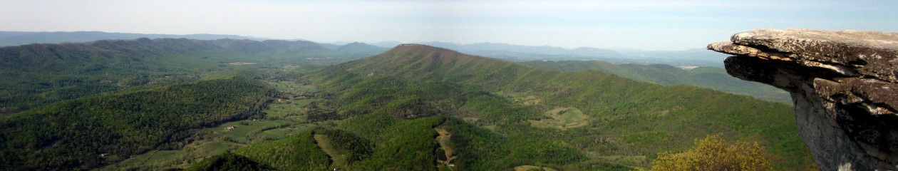
When we reached the summit the smell of wet scorched earth and grass filled the air across the vast bald, which very recently had been subject to a large scale controlled burn. The wind began to howl across the flat surface, hurling the rain which now poured, sideways across the landscape and pummeling our faces and bodies like frozen bullets. We were forced to lean into the wind to stabilise ourselves, which just meant a larger surface area was exposed to the icy daggers. We braced ourselves and marched as fast as possible to the relative safety of the tree line, nearly a half mile away. Once under cover and calm restored we pushed on. We reached the highest point of our walk, which was a mountain spring, and stopped to replenish water stocks. As I reached to fill the platypus container, I paused, hearing what I thought was the heavy wing beating of a grouse and the odd chest pounding noise it makes at such a low frequency it has caused some people to think it was inside their own head, some sort of rapidly accelerating heartbeat or their blood pressure.Apparently its something to do with mating or a show of strength that operates at a subwoofer level.
As I carried on filling, my head was drawn upwards to the source of the sound, causing me to spill some.of the icy cool water on my fingers. Something didn’t sound right. The grouse was morphing into sheets of metal being manipulated. Fran guessed they were building a shelter nearby which seemed a stretch but that is exactly what it sounded like. Then it hit me. ‘Fran’, I said, ‘thats not a grouse, that’s thunder’. Trademark, who we’d been leap frogging all morning, rounded the corner behind us. ‘Err, does anyone not like the sound of that?’, he said a little flustered. And that’s when it happened. It was as though someone had flicked a light switch. In an instant it was gloomy, then suddenly illuminated in every direction with the force of a thousand flash bulbs at once, followed in a nanosecond by a terrifying ‘CCCRRRAAAAACCCKKKK!!!!’. Lightning. And it was extremely close. The heavens opened and within seconds you could have gone trout fishing within the puddles forming around us. Trademark asked if he could stick with us and we hastily agreed as I packed the water filtration back into my pack and attached the pack cover, desperately trying not to let the downpour into my pack. I told the others to get moving as I finished up, the important thing now, to get to lower ground. Pack on, clips clipped, I started down the trail after them. Already drenched I didn’t even try to avoid the puddles. Marching straight through in my hasty pursuit. Lightning strikes continued to burst the blackness followed by the growl of thunder while the rain turned to hail so hard it felt like it could cut you. The others were moving through the gears so fast they were already nowhere in sight. Realising this, hey waited for me, and by the time I.caught them the lightning was thankfully moving away from us. We covered the 1.5 miles to the road at Elk Garden in exceptionally quick time and were out of the rain. We were safe. We even had a little trail magic, a red cooler with much needed sugary treats. Our friend Blue Jay was with with another hiker, Dallas, taking shelter under the porch of the car park restroom. Needless to say, we were happy and relieved to see friendly faces after our ordeal. Lightning has been known to strike (and kill!) hikers and atop a mountain is the last place you want to be! We moved on quickly to keep warm, heading uphill towards Thomas Knob shelter, a further 4.3 miles away. The walk was long amd exposed and whilst the hail and lightning had subsided, the rain and wind continued their relentless campaign. We reached the shelter but it was already nearing maximum occupancy, and tenting didn’t look ideal in the rocky terrain. We decided to push on another 5.1 to Wise shelter, which some south bounders had said was practically empty when they passed. The extra miles meant we would cross the 500 mile marker, and traverse the beautiful and famed Grayson Highlands, where wild ponies roam. In near white-out conditions we navigated over rocky boulders and exposed moors, not expecting to see any ponies as we ourselves were blinkered to all but the trail by our rain jackets. But to our complete surprise as we rounded a corner, framed by our hoods were two wild ponies grazing by a rocky outcrop. No time to chat, we exchanged equine pleasantries and powered on. Fingers numb, shoes and clothes drenched, but with our spirits high at nearly competing 17.3 miles in horrific conditions and crossing the 500 mile marker, we reached the shelter only to see 20 people gathered around it! Thankfully it was a school group who planned on tenting and with the worst of the weather blown away, and an excellent forecast for 10pm onwards, we found plenty of space in the shelter, changed our clothes, ate, climbed into our sleeping bags and marvelled at the remarkable day that was.
In the morning we rose and set off, unsure exactly how far we might walk. After just 3 miles due to some hidden blazes and lack of attention we took an unexpected detour up a separate trail called the Scales track. Whoops. A mile round trip later we’re back to where we went awry and heading toward Old Orchard Shelter. There were lots of day hikers around and after a long morning we stopped for lunch, chatting with some section hikers in the shelter. We walked on through the afternoon, passing Hurricane Mountain shelter where we met Mambo, Pip, Dfi and Haas who had heard from a day hiker that there was a diner just 2 miles off trail from Dickey Gap, in an easily hitchable area. We joined the mission to reach the diner, filling our thoughts with burgers and milkshakes. From Dickey Gap we stood perplexed. No signs and the people we asked said it had shut down the year before. It was gone 6pm and the only options were to wild camp or push on 4.5 miles to Trimpi shelter or a campsite shortly before. Tired but with few wild camping spots available, we pushed on, arriving at the shelter just before 8pm. Tired! We’d covered 20 miles in total and our feet felt it. We were quick to bed that night.
The next day most people in the camp were up early and by the time we emerged from the tent the final stragglers were preparing to leave and we were left to pack our stuff up alone. The terrain looked fairly easy going for the morning and just 10.6 miles away, and via a gazebo full of trail magic, was Partnership shelter, one of the most popular on the trail.

The shelter fits a whopping 16 people and has a solar shower. The Mount Rogers Visitor Centre is just a few yards away, and the town of Marion is easily accessible from the nearby road. Oh, and importantly, pizza restaurants will deliver to the shelter! Others who arrived there at the same time ordered pizza, but we were thinking instead of heading to the next shelter and getting our resupply at the convenience store in Atkins rather than in Marion. We arrived at the next shelter at 6pm, and as we were feeling fairly spritely still, decided in a rather radical decision to walk another 4.5 miles to Atkins. We did what we now refer to as ‘doing an Atkins’ which means pushing a bigger mile day to get to town late and leave first thing in the morning without getting sucked into the town vortex, but still reaping all the benefits. On our way we passed some fantastic trail magic in an old village school house.

Not only did the magic feature the usual sodas and chocolate but a vast selection of first aid, general hiker supplies and fresh fruit. It was fantastic. We thoroughly enjoyed the walk down into Atkins. Plants were starting to bloom, all shades of greens were present in the lush woods, and blossom added sweet scents to the forest air. Virginia felt alive. We saw an otter as we crossed some wetlands and streams, crossed a rail road, and then arrived just as the sun was setting, around 8.15pm. We’d breezed through 22.2 miles. The Barn restaurant we’d heard about had just shut sadly, but we took a room at the Relax Inn before heading to the gas station to resupply. We were pleasantly surprised to find we could get enough hiker-suitable food for the next few days and after some pleasant chats with random gas station truckers, we headed back to our slightly smelly motel room to order pizza. We packed up our supplies so we were ready to head out at 9am the next day.
Thus day 49 began, and after tearing ourselves away from watching Indiana Jones in the motel room, the first stop was The Barn restaurant for breakfast. A plateful of eggs and sausage later, we staggered across the Interstate 81 underpass to start our hike. Both of us feeling a little too full for walking. After an exciting sighting of a wild turkey and the happy realisation that by being a little after mile 546 we were a quarter of the way through the AT, we had a moment of worry as thunder and lighting struck. We double-timed it, hoping to find shelter, but thankfully the storm was only brief. We crossed some meadows, passed some cows, hopped over fence stiles and saw our first deer! After an unexpectedly hard climb up Brushey we decided to pull in for the night a Knot Maul Branch shelter, after 13.9 miles. We were at mile 556.6 and had only been at the shelter 10 minutes before it started to rain, making our decision to stop even more satisfying. Seven of us slept there, a friendly bunch including two Germans, two Americans and a Brit/New Zealander.
The morning of day 51 began with one of our shelter fellows offering us some hot cider. In the USA ‘cider’ is non-alcoholic unless called ‘hard cider’. So no, we weren’t hitting the booze that early! We headed off at 9am and after 5 miles started a massive climb of 2,000 feet to Chestnut Knob shelter. The shelter is a fully enclosed concrete block structure, so we dived in for lunch, luckily choosing just the right time as it rained for the next half hour. We met another thru-hiker called Caveman and discussed the possibility of heading to Fort Bastian that evening, home of TruBrit, an ex-pat ex-SAS soldier now in the process of setting up an outdoor education centre and offering hikers a fun night off the trail camping in his forest. The miles that afternoon took longer than expected however, as the ridgeline we’d seen detailed in our guide turned out to be a form of rocky torture. The last 5 miles however, were easy undulating terrain and we raced to meet TruBrit. We set a new record for the day, hiking 23.9 miles. We jumped into TruBrits landrover and were driven over higgledy piggledy backroads to the heart of his 35 acres.

Despite arriving late, the evening was only just beginning. It was a fellow hiker’s birthday so the ‘party tent’, complete with surround sound, was filled with beer and whiskey. We sang along to Paul Simon’s Graceland, toasted to good health and chatted into the early hours with new friends.
Following a camp breakfast at 7.30am we got a lift back to trail the for day 52. We passed turn offs for towns called Bland and Bastian, and a sign for the Trail Boss trail!

We traversed a long ridge line with few if not no water sources for a long while, aiming for Jenny Knob shelter. We made it there around 7.40pm with time to cook and get water just before we lost the light. A long hard day, but a good solid 19 miles. We met Big Gulp and Pretty Bird, Pumba, Kalpacca and a load of others.
We were the last out the next morning, which in the long run doesn’t mean much but at the time makes you feel a little lazy. It was a fun walk with a suspension bridge, half a packet of doritos and a can of beer for trail magic, and a picturesque riverside lunch spot.

But the long mile days previous were taking their toll and we struggled through the 1,300 foot climb after Wapiti shelter. We had to carry an extra litre of water as there were no more sources for 10 miles. We spent the night at Big Horse Gap, our first ever experience of wild camping alone. We had a small fire and enjoyed the solitude.

There were some rather interesting noises in the night. In particular a sneezing growl from a large-sounding animal that was probably a bear…and that was the end of day 53. We were at mile 619.3 and had covered another 19.8 that day. The following day we were to head to Pearisburg, but more on that next time 🙂
Bear hugs,
H & F xxx

This stuff is just amazing and so brilliantly written you are great with words it just makes me want to read more… you are having a great time and we are all so happy for you, you write very descriptively you could make this a book!! God bless u both. Deep meet pallu shashi xxxx